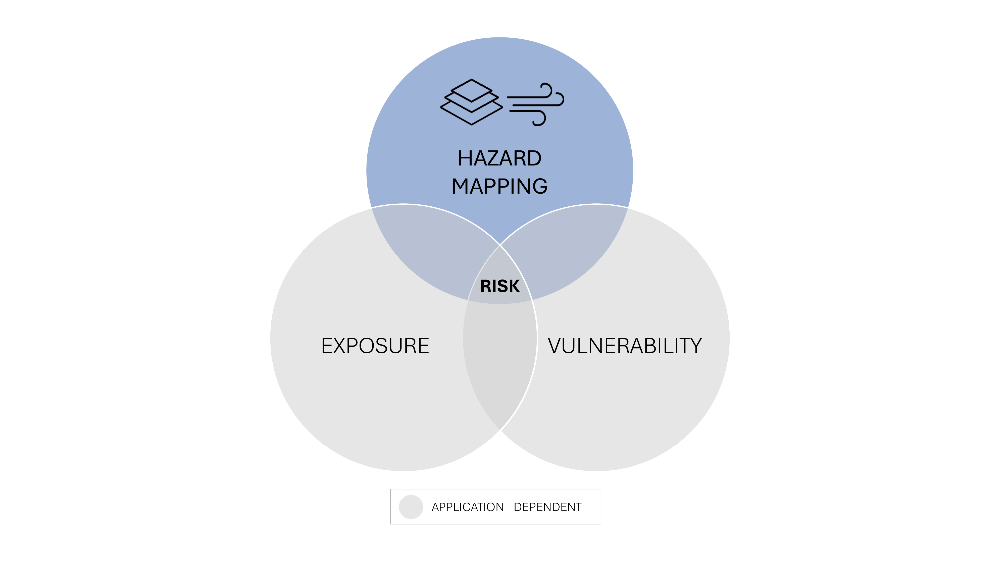
Risk assessment
for planning and decision-making towards safety requires the mapping of
hazard, exposure and vulnerability
Mapping Wind Hazard Patterns in space and Evolution in time
is the primary step of the risk assessment chain
Every built and environmental system lies on its own site
Every infrastructure crosses specific territories
Planners need detailed wind hazard mapping at the proper scales
Hazard mapping
Macro-meso wind maps
Mesoscale mapping of risk index
Wind-induced tree collapse along railways
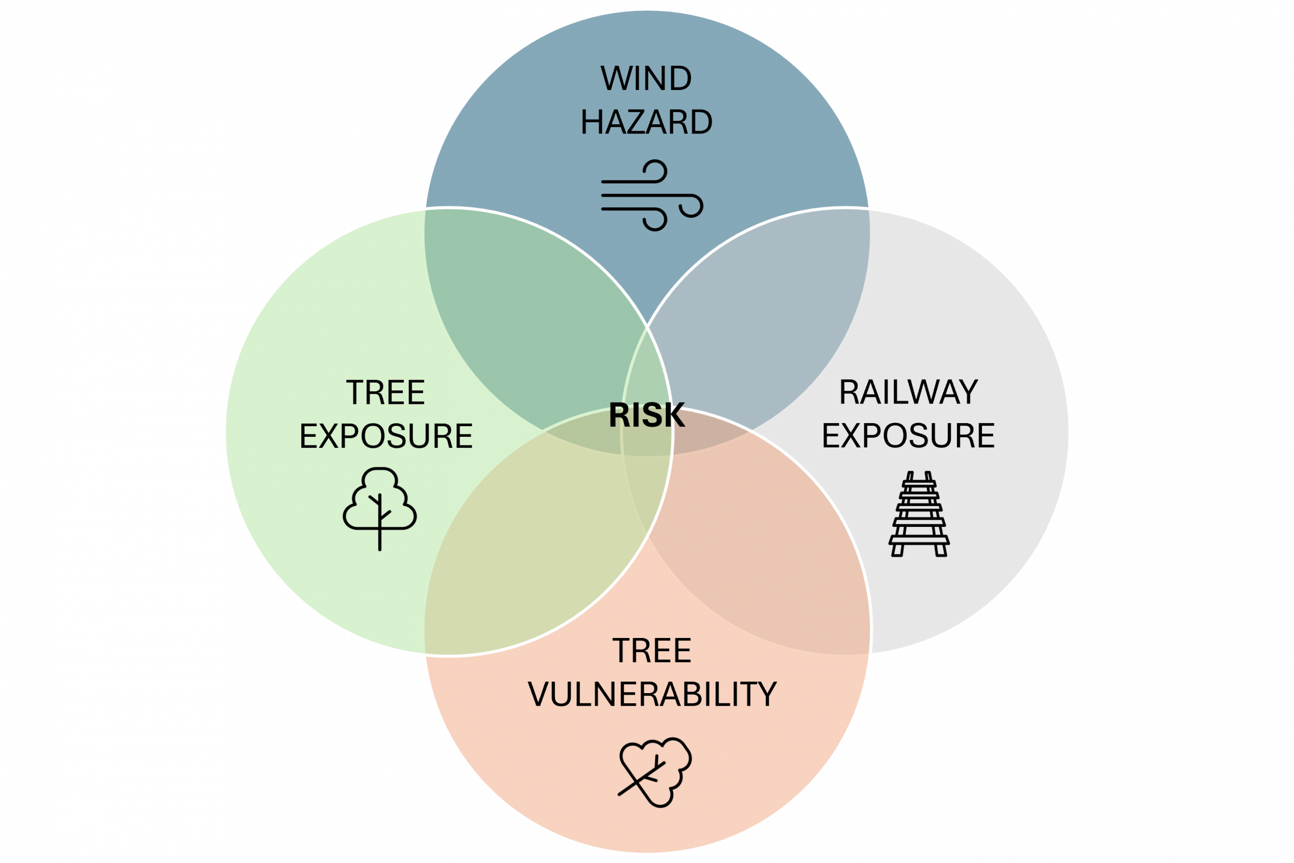
A site-specific application of the wind-induced risk assessment methodology,
tailored to a specific critical infrastructure and region, with potential for replication across other critical sites.